 vesseltracker.com
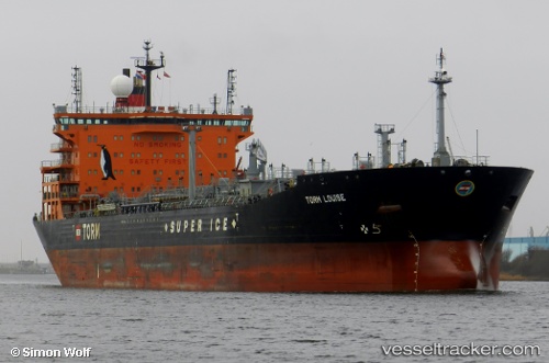
Vessel Torm Louise IMO: 9392482, MMSI: 219014000 Chemical Oil Products Tanker
UTC, 40.63858, -74.06407, course: 349, speed: 0.2
UTC, 40.63819, -74.06383, course: 343, speed: 0.1
2026-02-03 19:44:05 UTC, 40.63830, -74.06526, course: 14, speed: 0.1
Live AIS position:
UTC. Near Tompkinsville),
updated 2026-02-03 19:44:05 UTC.
Find the position of the vessel Torm Louise on the map. The latter are known coordinates and path.
marine traffic ship tracker show on live map
The current position of vessel Torm Louise is 40.63830 lat / -74.06526 lng. Updated: 2026-02-03 19:44:05 UTCCurrently sailing under the flag of Denmark
Torm Louise built in 2009 year
Deadweight:
53160 tDetails:
Last coordinates of the vessel:
UTC, 40.64234, -74.06339, course: 221, speed: 0.2UTC, 40.63858, -74.06407, course: 349, speed: 0.2
UTC, 40.63819, -74.06383, course: 343, speed: 0.1
2026-02-03 19:44:05 UTC, 40.63830, -74.06526, course: 14, speed: 0.1