 vesseltracker.com
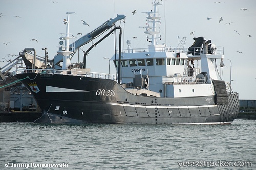
Vessel AHLMA WEST IMO: 8741416, MMSI: 219026170 Fishing Vessel
UTC, 57.64498, 11.85847, course: 21, speed: 0
UTC, 57.64498, 11.85849, course: 22, speed: 0
2026-02-28 15:56:08 UTC, 57.64498, 11.85848, course: 21, speed: 0
Live AIS position:
UTC. Near WEST FROLUNDA),
updated 2026-02-28 15:56:08 UTC.
Find the position of the vessel AHLMA WEST on the map. The latter are known coordinates and path.
marine traffic ship tracker show on live map
The current position of vessel AHLMA WEST is 57.64498 lat / 11.85848 lng. Updated: 2026-02-28 15:56:08 UTCCurrently sailing under the flag of Denmark
AHLMA WEST built in 2005 year
Deadweight:
787 tDetails:
Last coordinates of the vessel:
UTC, 57.64499, 11.85848, course: 22, speed: 0UTC, 57.64498, 11.85847, course: 21, speed: 0
UTC, 57.64498, 11.85849, course: 22, speed: 0
2026-02-28 15:56:08 UTC, 57.64498, 11.85848, course: 21, speed: 0