 vesseltracker.com
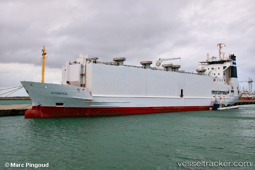
Vessel ALONDRA IMO: 9113719, MMSI: 219028212 Livestock Carrier
UTC, 28.26742, -15.14032, course: 59, speed: 7.8
UTC, 28.42509, -14.82564, course: 59, speed: 8.4
2026-03-06 16:25:15 UTC, 28.63030, -14.55824, course: 44, speed: 7.3
Live Vessel ALONDRA Analytics (details, animations, etc.)
Live AIS position: UTC. 30 nm W of Llanos de la Concepcion), updated 2026-03-06 16:25:15 UTC.Find the position of the vessel ALONDRA on the map. The latter are known coordinates and path.
marine traffic ship tracker show on live map
The current position of vessel ALONDRA is 28.63030 lat / -14.55824 lng. Updated: 2026-03-06 16:25:15 UTCCurrently sailing under the flag of Denmark (DIS)
ALONDRA built in 1995 year
Deadweight:
2796 tDetails:
Last coordinates of the vessel:
UTC, 28.15122, -15.37700, course: 58, speed: 7.8UTC, 28.26742, -15.14032, course: 59, speed: 7.8
UTC, 28.42509, -14.82564, course: 59, speed: 8.4
2026-03-06 16:25:15 UTC, 28.63030, -14.55824, course: 44, speed: 7.3