 vesseltracker.com
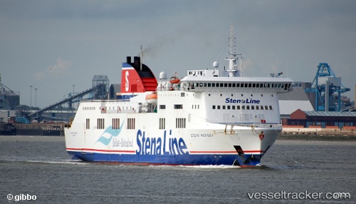
Vessel STENA BALTICA IMO: 9329851, MMSI: 219029947 Passenger/Ro-Ro Ship (vehicles)
UTC, 58.37056, 18.92785, course: 316, speed: 16.7
UTC, 58.60428, 18.49436, course: 316, speed: 16.9
2026-02-18 05:40:31 UTC, 58.93811, 17.98068, course: 149, speed: 0
Live AIS position:
UTC. Near NYNASHAMN),
updated 2026-02-18 05:40:31 UTC.
Find the position of the vessel STENA BALTICA on the map. The latter are known coordinates and path.
marine traffic ship tracker show on live map
The current position of vessel STENA BALTICA is 58.93811 lat / 17.98068 lng. Updated: 2026-02-18 05:40:31 UTCCurrently sailing under the flag of Denmark (DIS)
STENA BALTICA built in 2005 year
Deadweight:
7000 tDetails:
Last coordinates of the vessel:
UTC, 57.64073, 20.87973, course: 302, speed: 17.1UTC, 58.37056, 18.92785, course: 316, speed: 16.7
UTC, 58.60428, 18.49436, course: 316, speed: 16.9
2026-02-18 05:40:31 UTC, 58.93811, 17.98068, course: 149, speed: 0