 vesseltracker.com
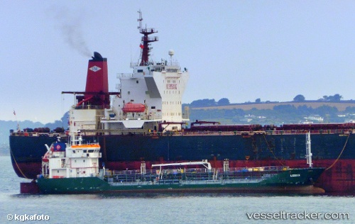
Vessel ANDREA IMO: 9428188, MMSI: 219031446 Oil Products Tanker
UTC, 70.63112, 23.65177, course: 218, speed: 0
UTC, 70.63108, 23.65170, course: 218, speed: 0
2026-03-08 05:39:37 UTC, 70.63109, 23.65178, course: 218, speed: 0
Live Vessel ANDREA Analytics (details, animations, etc.)
Live AIS position: UTC. Near RYPEFJORD), updated 2026-03-08 05:39:37 UTC.Find the position of the vessel ANDREA on the map. The latter are known coordinates and path.
marine traffic ship tracker show on live map
The current position of vessel ANDREA is 70.63109 lat / 23.65178 lng. Updated: 2026-03-08 05:39:37 UTCCurrently sailing under the flag of Denmark
ANDREA built in 2008 year
Deadweight:
1942 tDetails:
Last coordinates of the vessel:
UTC, 70.63108, 23.65170, course: 218, speed: 0UTC, 70.63112, 23.65177, course: 218, speed: 0
UTC, 70.63108, 23.65170, course: 218, speed: 0
2026-03-08 05:39:37 UTC, 70.63109, 23.65178, course: 218, speed: 0