 vesseltracker.com
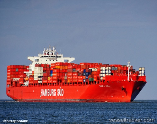
Vessel Santa Rita IMO: 9425382, MMSI: 219085000 Container Ship
UTC, 51.95806, 4.04315, course: 82, speed: 0
UTC, 51.95804, 4.04328, course: 82, speed: 0
2026-01-29 01:27:15 UTC, 51.95801, 4.04318, course: 82, speed: 0
Live AIS position:
UTC. Near MAASVLAKTE - ROTTERDAM),
updated 2026-01-29 01:27:15 UTC.
Find the position of the vessel Santa Rita on the map. The latter are known coordinates and path.
marine traffic ship tracker show on live map
The current position of vessel Santa Rita is 51.95801 lat / 4.04318 lng. Updated: 2026-01-29 01:27:15 UTCCurrently sailing under the flag of Denmark
Santa Rita built in 2011 year
Deadweight:
93404 tDetails:
Last coordinates of the vessel:
UTC, 51.95805, 4.04324, course: 82, speed: 0UTC, 51.95806, 4.04315, course: 82, speed: 0
UTC, 51.95804, 4.04328, course: 82, speed: 0
2026-01-29 01:27:15 UTC, 51.95801, 4.04318, course: 82, speed: 0