 vesseltracker.com
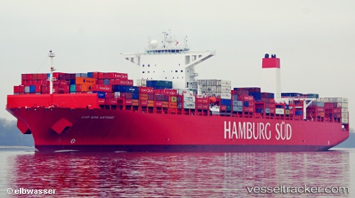
Vessel Cap San Antonio IMO: 9622241, MMSI: 219095000 Container Ship
UTC, 22.33743, 114.11572, course: 342, speed: 0
UTC, 22.33743, 114.11572, course: 342, speed: 0
2026-02-20 14:22:37 UTC, 22.33743, 114.11572, course: 342, speed: 0
Live AIS position:
UTC. Near Lai Chi Kok),
updated 2026-02-20 14:22:37 UTC.
Find the position of the vessel Cap San Antonio on the map. The latter are known coordinates and path.
marine traffic ship tracker show on live map
The current position of vessel Cap San Antonio is 22.33743 lat / 114.11572 lng. Updated: 2026-02-20 14:22:37 UTCCurrently sailing under the flag of Denmark
Cap San Antonio built in 2014 year
Deadweight:
124424 tDetails:
Last coordinates of the vessel:
UTC, 22.33740, 114.11578, course: 342, speed: 0UTC, 22.33743, 114.11572, course: 342, speed: 0
UTC, 22.33743, 114.11572, course: 342, speed: 0
2026-02-20 14:22:37 UTC, 22.33743, 114.11572, course: 342, speed: 0