 vesseltracker.com
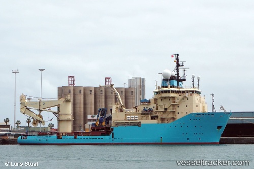
Vessel Maersk Achiever IMO: 9245902, MMSI: 219146000 Offshore Tug Supply Ship
UTC, 44.10797, 28.66373, course: 93, speed: 0
UTC, 44.10797, 28.66373, course: 93, speed: 0
2026-01-14 04:40:37 UTC, 44.10796, 28.66373, course: 93, speed: 0
Live AIS position:
UTC. Near Agigea),
updated 2026-01-14 04:40:37 UTC.
Find the position of the vessel Maersk Achiever on the map. The latter are known coordinates and path.
marine traffic ship tracker show on live map
The current position of vessel Maersk Achiever is 44.10796 lat / 28.66373 lng. Updated: 2026-01-14 04:40:37 UTCCurrently sailing under the flag of Denmark
Maersk Achiever built in 2003 year
Deadweight:
4577 tDetails:
Last coordinates of the vessel:
UTC, 44.10796, 28.66373, course: 93, speed: 0UTC, 44.10797, 28.66373, course: 93, speed: 0
UTC, 44.10797, 28.66373, course: 93, speed: 0
2026-01-14 04:40:37 UTC, 44.10796, 28.66373, course: 93, speed: 0