 vesseltracker.com
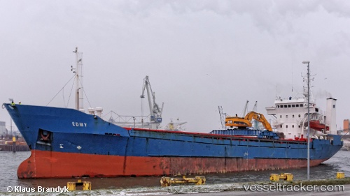
Vessel Mv Enny IMO: 7926409, MMSI: 219164000 Multi Purpose Carrier
UTC, 57.22129, 10.72615, course: 2, speed: 12.2
UTC, 57.43693, 10.74668, course: 6, speed: 11.6
2026-01-17 03:58:30 UTC, 57.65185, 10.77253, course: 3, speed: 11.3
Live AIS position:
UTC. Near SKAGEN),
updated 2026-01-17 03:58:30 UTC.
Find the position of the vessel Mv Enny on the map. The latter are known coordinates and path.
marine traffic ship tracker show on live map
The current position of vessel Mv Enny is 57.65185 lat / 10.77253 lng. Updated: 2026-01-17 03:58:30 UTCCurrently sailing under the flag of Denmark
Mv Enny built in 1980 year
Deadweight:
3750 tDetails:
Last coordinates of the vessel:
UTC, 57.03359, 10.59409, course: 37, speed: 10.1UTC, 57.22129, 10.72615, course: 2, speed: 12.2
UTC, 57.43693, 10.74668, course: 6, speed: 11.6
2026-01-17 03:58:30 UTC, 57.65185, 10.77253, course: 3, speed: 11.3