 vesseltracker.com
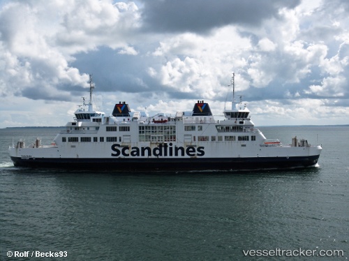
Vessel Tycho Brahe IMO: 9007116, MMSI: 219230000 Passenger Ro Ro Cargo Ship
UTC, 56.04360, 12.69056, course: -1, speed: 0.2
UTC, 56.04317, 12.69085, course: -1, speed: 1
2026-02-27 23:51:43 UTC, 56.04324, 12.69113, course: 69, speed: 0
Live AIS position:
UTC. Near Halsingborg),
updated 2026-02-27 23:51:43 UTC.
Find the position of the vessel Tycho Brahe on the map. The latter are known coordinates and path.
marine traffic ship tracker show on live map
The current position of vessel Tycho Brahe is 56.04324 lat / 12.69113 lng. Updated: 2026-02-27 23:51:43 UTCCurrently sailing under the flag of Denmark
Tycho Brahe built in 1991 year
Deadweight:
2500 tDetails:
Last coordinates of the vessel:
UTC, 56.04165, 12.68661, course: 42, speed: 7.8UTC, 56.04360, 12.69056, course: -1, speed: 0.2
UTC, 56.04317, 12.69085, course: -1, speed: 1
2026-02-27 23:51:43 UTC, 56.04324, 12.69113, course: 69, speed: 0