 vesseltracker.com
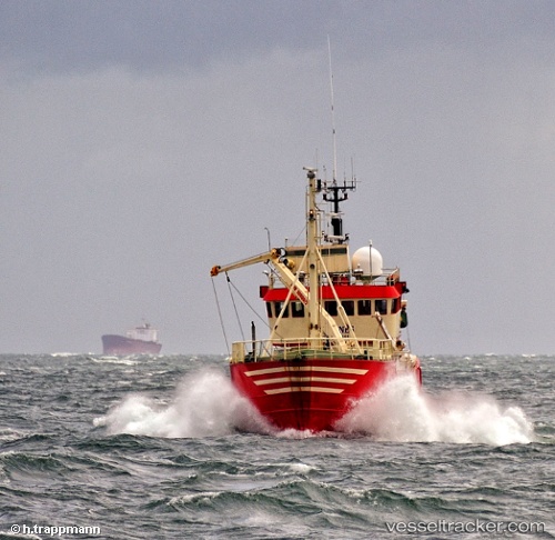
Vessel Reykjanes Guard IMO: 7392311, MMSI: 219329000 Standby Safety Vessel
UTC, 55.47909, 8.42009, course: 239, speed: 0
UTC, 55.47908, 8.42009, course: 242, speed: 0.1
2026-01-29 10:05:41 UTC, 55.47907, 8.42009, course: 242, speed: 0.1
Live AIS position:
UTC. Near Esbjerg),
updated 2026-01-29 10:05:41 UTC.
Find the position of the vessel Reykjanes Guard on the map. The latter are known coordinates and path.
marine traffic ship tracker show on live map
The current position of vessel Reykjanes Guard is 55.47907 lat / 8.42009 lng. Updated: 2026-01-29 10:05:41 UTCCurrently sailing under the flag of Denmark
Reykjanes Guard built in 1974 year
Deadweight:
427 tDetails:
Last coordinates of the vessel:
UTC, 55.47908, 8.42008, course: 241, speed: 0UTC, 55.47909, 8.42009, course: 239, speed: 0
UTC, 55.47908, 8.42009, course: 242, speed: 0.1
2026-01-29 10:05:41 UTC, 55.47907, 8.42009, course: 242, speed: 0.1