 vesseltracker.com
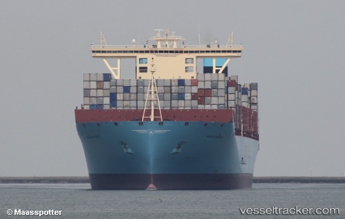
Vessel Maren Maersk IMO: 9632129, MMSI: 219620000 Container Ship
UTC, 2.29440, 101.85102, course: 317, speed: 11.8
UTC, 2.41123, 101.72018, course: 309, speed: 13.8
2026-01-16 23:36:57 UTC, 2.57130, 101.51025, course: 306, speed: 14.5
Live AIS position:
UTC. 12 nm S of Kuala Langat),
updated 2026-01-16 23:36:57 UTC.
Find the position of the vessel Maren Maersk on the map. The latter are known coordinates and path.
marine traffic ship tracker show on live map
The current position of vessel Maren Maersk is 2.57130 lat / 101.51025 lng. Updated: 2026-01-16 23:36:57 UTCCurrently sailing under the flag of Denmark
Details:
Last coordinates of the vessel:
UTC, 2.11223, 102.06502, course: 308, speed: 14.1UTC, 2.29440, 101.85102, course: 317, speed: 11.8
UTC, 2.41123, 101.72018, course: 309, speed: 13.8
2026-01-16 23:36:57 UTC, 2.57130, 101.51025, course: 306, speed: 14.5