 vesseltracker.com
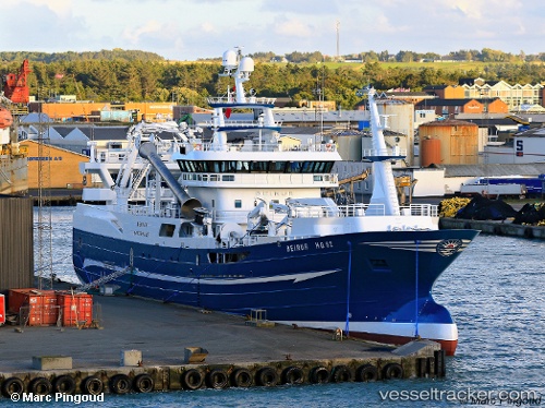
Vessel Beinur IMO: 9746097, MMSI: 219731000 Fishing Vessel
UTC, 61.55375, -6.81022, course: 289, speed: 0
UTC, 61.55380, -6.81022, course: 288, speed: 0
2026-01-16 19:12:02 UTC, 61.55379, -6.81004, course: 289, speed: 0
Live AIS position:
UTC. Near Tvoroyri),
updated 2026-01-16 19:12:02 UTC.
Find the position of the vessel Beinur on the map. The latter are known coordinates and path.
marine traffic ship tracker show on live map
The current position of vessel Beinur is 61.55379 lat / -6.81004 lng. Updated: 2026-01-16 19:12:02 UTCCurrently sailing under the flag of Denmark
Details:
Last coordinates of the vessel:
UTC, 61.55372, -6.81018, course: 289, speed: 0UTC, 61.55375, -6.81022, course: 289, speed: 0
UTC, 61.55380, -6.81022, course: 288, speed: 0
2026-01-16 19:12:02 UTC, 61.55379, -6.81004, course: 289, speed: 0