 vesseltracker.com
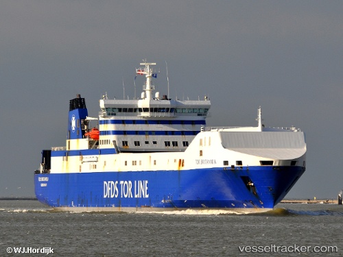
Vessel Britannia Seaways IMO: 9153032, MMSI: 219825000 Ro Ro Cargo Ship
UTC, 53.63790, -0.19905, course: 130, speed: 0
UTC, 53.64127, 0.37305, course: -1, speed: 17.2
2026-03-12 21:54:58 UTC, 53.88667, 1.05667, course: -1, speed: 18
Live Vessel Britannia Seaways Analytics (details, animations, etc.)
Live AIS position: UTC. 24 nm SE of Weaverthorpe), updated 2026-03-12 21:54:58 UTC.Find the position of the vessel Britannia Seaways on the map. The latter are known coordinates and path.
marine traffic ship tracker show on live map
The current position of vessel Britannia Seaways is 53.88667 lat / 1.05667 lng. Updated: 2026-03-12 21:54:58 UTCCurrently sailing under the flag of Denmark
Britannia Seaways built in 2000 year
Deadweight:
11089 tDetails:
Last coordinates of the vessel:
UTC, 53.63790, -0.19905, course: 131, speed: 0UTC, 53.63790, -0.19905, course: 130, speed: 0
UTC, 53.64127, 0.37305, course: -1, speed: 17.2
2026-03-12 21:54:58 UTC, 53.88667, 1.05667, course: -1, speed: 18