 vesseltracker.com
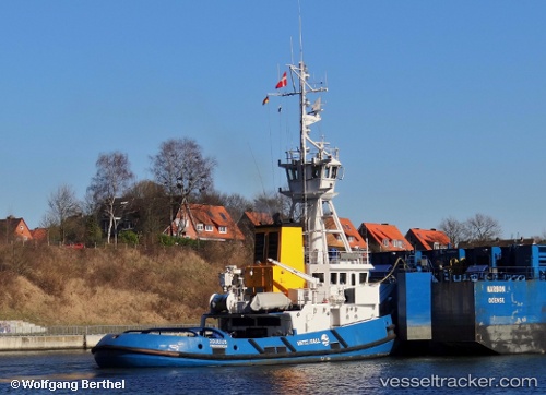
Vessel Joulius IMO: 8802064, MMSI: 219850000 Pusher Tug
UTC, 55.60037, 12.48192, course: 351, speed: 0
UTC, 55.60121, 12.48260, course: 157, speed: 0
2026-02-22 09:50:20 UTC, 55.60123, 12.48260, course: 157, speed: 0
Live AIS position:
UTC. Near AVEDORE),
updated 2026-02-22 09:50:20 UTC.
Find the position of the vessel Joulius on the map. The latter are known coordinates and path.
marine traffic ship tracker show on live map
The current position of vessel Joulius is 55.60123 lat / 12.48260 lng. Updated: 2026-02-22 09:50:20 UTCCurrently sailing under the flag of Denmark
Joulius built in 1989 year
Deadweight:
147 tDetails:
Last coordinates of the vessel:
UTC, 55.60121, 12.48260, course: 156, speed: 0UTC, 55.60037, 12.48192, course: 351, speed: 0
UTC, 55.60121, 12.48260, course: 157, speed: 0
2026-02-22 09:50:20 UTC, 55.60123, 12.48260, course: 157, speed: 0