 vesseltracker.com
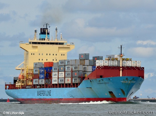
Vessel Johannes Maersk IMO: 9215189, MMSI: 219982000 Container Ship
UTC, 52.82065, 3.26286, course: 30, speed: 10.4
UTC, 53.19274, 3.52725, course: 22, speed: 9.6
2026-02-23 21:58:01 UTC, 53.42252, 3.70350, course: 18, speed: 9
Live AIS position:
UTC. 13 nm S of Neeltje Jans),
updated 2026-02-23 21:58:01 UTC.
Find the position of the vessel Johannes Maersk on the map. The latter are known coordinates and path.
marine traffic ship tracker show on live map
The current position of vessel Johannes Maersk is 53.42252 lat / 3.70350 lng. Updated: 2026-02-23 21:58:01 UTCDetails:
Last coordinates of the vessel:
UTC, 52.54569, 3.03637, course: 27, speed: 10.2UTC, 52.82065, 3.26286, course: 30, speed: 10.4
UTC, 53.19274, 3.52725, course: 22, speed: 9.6
2026-02-23 21:58:01 UTC, 53.42252, 3.70350, course: 18, speed: 9