 vesseltracker.com
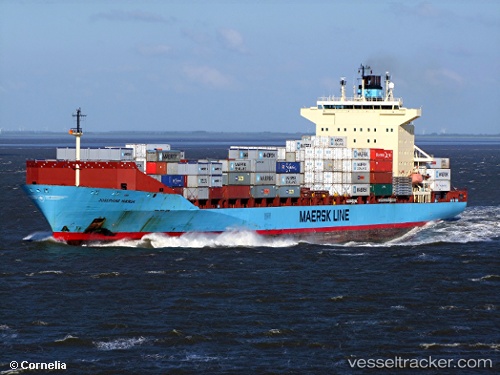
Vessel Josephine Maersk IMO: 9215191, MMSI: 220008000 Container Ship
UTC, -6.09369, 106.91948, course: 180, speed: 0
UTC, -6.09368, 106.91948, course: 181, speed: 0
2026-03-09 17:47:08 UTC, -6.09366, 106.91948, course: 180, speed: 0
Live Vessel Josephine Maersk Analytics (details, animations, etc.)
Live AIS position: UTC. Near New Priok Port), updated 2026-03-09 17:47:08 UTC.Find the position of the vessel Josephine Maersk on the map. The latter are known coordinates and path.
marine traffic ship tracker show on live map
The current position of vessel Josephine Maersk is -6.09366 lat / 106.91948 lng. Updated: 2026-03-09 17:47:08 UTCCurrently sailing under the flag of Denmark
Josephine Maersk built in 2002 year
Deadweight:
35082 tDetails:
Last coordinates of the vessel:
UTC, -6.09368, 106.91949, course: 179, speed: 0UTC, -6.09369, 106.91948, course: 180, speed: 0
UTC, -6.09368, 106.91948, course: 181, speed: 0
2026-03-09 17:47:08 UTC, -6.09366, 106.91948, course: 180, speed: 0