 vesseltracker.com
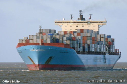
Clementine Maersk
Current StatusWhere is the vessel?
Clementine Maersk is currently in 23 nm E of Tybee Island, based on AIS data received about 3h ago.
Latest AIS update:
Current position: 31.85653° N, 80.40759° W (23 nm E of Tybee Island)
Average speed (last 7 days): Loading…
Average speed (last 30 days): Loading…
Vessel profile: Clementine Maersk is a Container Ship with dimensions 42m x 347m.
This page combines live AIS, route history, probable destination signals, nearby traffic, and port activity for practical vessel monitoring.
The current position of vessel Clementine Maersk is 31.85653 lat / -80.40759 lng. Updated: 2026-03-28 11:23:43 UTCNearest reference points:
- 33 nm S of Kiawah Island
- Near Saint Andrews
- Near Charleston
Details:
Live Vessel Clementine Maersk Analytics (details, animations, etc.)
Recent AIS points (UTC):
2026-03-28 05:31:23 UTC · 32.27897, -79.77259 · SOG 7.8 kn · COG 216°2026-03-28 08:12:32 UTC · 32.07458, -80.08435 · SOG 7.2 kn · COG 235°
2026-03-28 10:03:53 UTC · 31.93531, -80.31241 · SOG 8.3 kn · COG 233°
2026-03-28 11:23:43 UTC · 31.85653, -80.40759 · SOG 3.6 kn · COG 30°