 vesseltracker.com
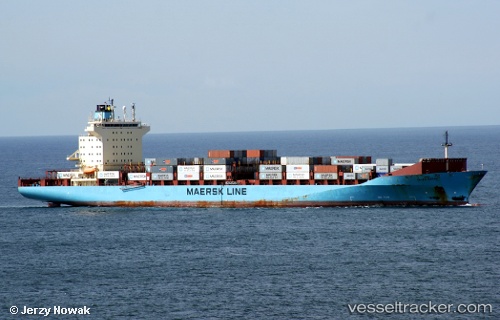
Vessel Olivia Maersk IMO: 9251638, MMSI: 220216000 Container Ship
UTC, -33.97020, 151.21669, course: 249, speed: 0
UTC, -33.97020, 151.21669, course: 249, speed: 0
2026-03-25 01:54:20 UTC, -33.97019, 151.21669, course: 249, speed: 0
Live Vessel Olivia Maersk Analytics (details, animations, etc.)
Live AIS position: UTC. Near BOTANY), updated 2026-03-25 01:54:20 UTC.Find the position of the vessel Olivia Maersk on the map. The latter are known coordinates and path.
marine traffic ship tracker show on live map
The current position of vessel Olivia Maersk is -33.97019 lat / 151.21669 lng. Updated: 2026-03-25 01:54:20 UTCDetails:
Last coordinates of the vessel:
UTC, -33.97020, 151.21667, course: 249, speed: 0UTC, -33.97020, 151.21669, course: 249, speed: 0
UTC, -33.97020, 151.21669, course: 249, speed: 0
2026-03-25 01:54:20 UTC, -33.97019, 151.21669, course: 249, speed: 0