 vesseltracker.com
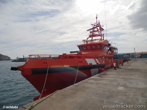
Vessel Guardamar Talia IMO: 9541667, MMSI: 224184000 Search And Rescue Vessel
UTC, 36.71670, -4.41842, course: 145, speed: 0
UTC, 36.71669, -4.41841, course: 144, speed: 0
2026-01-13 23:04:41 UTC, 36.71667, -4.41833, course: -1, speed: 0
Live AIS position:
UTC. Near Yunquera),
updated 2026-01-13 23:04:41 UTC.
Find the position of the vessel Guardamar Talia on the map. The latter are known coordinates and path.
marine traffic ship tracker show on live map
The current position of vessel Guardamar Talia is 36.71667 lat / -4.41833 lng. Updated: 2026-01-13 23:04:41 UTCCurrently sailing under the flag of Spain
Guardamar Talia built in 2009 year
Deadweight:
21 tDetails:
Last coordinates of the vessel:
UTC, 36.71669, -4.41840, course: 145, speed: 0UTC, 36.71670, -4.41842, course: 145, speed: 0
UTC, 36.71669, -4.41841, course: 144, speed: 0
2026-01-13 23:04:41 UTC, 36.71667, -4.41833, course: -1, speed: 0