 vesseltracker.com
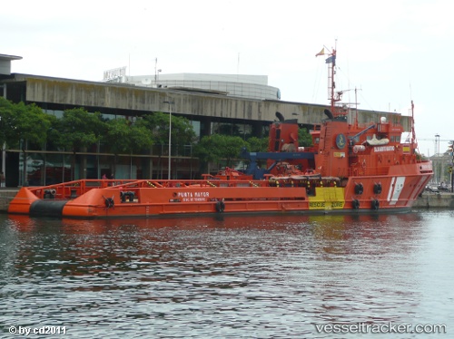
Vessel Punta Mayor IMO: 8305066, MMSI: 224564000 Offshore Tug Supply Ship
UTC, 39.97367, 0.01927, course: -1, speed: 0
UTC, 39.97369, 0.01930, course: -1, speed: 0
2026-02-05 01:23:17 UTC, 39.97370, 0.01933, course: -1, speed: 0
Live AIS position:
UTC. Near El Grao),
updated 2026-02-05 01:23:17 UTC.
Find the position of the vessel Punta Mayor on the map. The latter are known coordinates and path.
marine traffic ship tracker show on live map
The current position of vessel Punta Mayor is 39.97370 lat / 0.01933 lng. Updated: 2026-02-05 01:23:17 UTCCurrently sailing under the flag of Spain
Punta Mayor built in 1984 year
Deadweight:
1218 tDetails:
Last coordinates of the vessel:
UTC, 39.97368, 0.01931, course: -1, speed: 0UTC, 39.97367, 0.01927, course: -1, speed: 0
UTC, 39.97369, 0.01930, course: -1, speed: 0
2026-02-05 01:23:17 UTC, 39.97370, 0.01933, course: -1, speed: 0