 vesseltracker.com
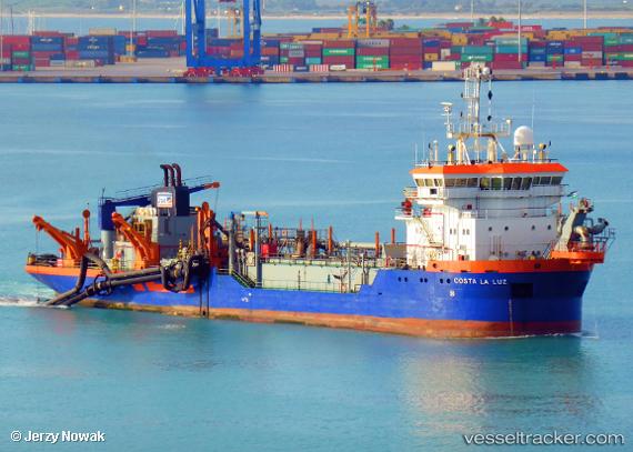
Vessel Costa La Luz IMO: 9145217, MMSI: 224611000 Hopper Dredger
UTC, 38.48646, -8.93131, course: 38, speed: 9.7
UTC, 38.47118, -8.78372, course: 275, speed: 0.8
2026-01-16 08:48:20 UTC, 38.47095, -8.78029, course: 266, speed: 1.1
Live AIS position:
UTC. Near Comporta),
updated 2026-01-16 08:48:20 UTC.
Find the position of the vessel Costa La Luz on the map. The latter are known coordinates and path.
marine traffic ship tracker show on live map
The current position of vessel Costa La Luz is 38.47095 lat / -8.78029 lng. Updated: 2026-01-16 08:48:20 UTCCurrently sailing under the flag of Spain
Costa La Luz built in 1997 year
Deadweight:
4907 tDetails:
Last coordinates of the vessel:
UTC, 38.49934, -8.90914, course: 252, speed: 10.8UTC, 38.48646, -8.93131, course: 38, speed: 9.7
UTC, 38.47118, -8.78372, course: 275, speed: 0.8
2026-01-16 08:48:20 UTC, 38.47095, -8.78029, course: 266, speed: 1.1