 vesseltracker.com
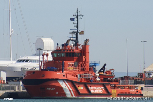
Vessel Marta Mata IMO: 9429120, MMSI: 224634000 Tug
UTC, 41.37293, 2.18028, course: 126, speed: 0
UTC, 41.37295, 2.18026, course: 126, speed: 0
2026-01-16 07:59:26 UTC, 41.37292, 2.18031, course: 126, speed: 0
Live AIS position:
UTC. Near Barcelona),
updated 2026-01-16 07:59:26 UTC.
Find the position of the vessel Marta Mata on the map. The latter are known coordinates and path.
marine traffic ship tracker show on live map
The current position of vessel Marta Mata is 41.37292 lat / 2.18031 lng. Updated: 2026-01-16 07:59:26 UTCCurrently sailing under the flag of Spain
Marta Mata built in 2008 year
Deadweight:
550 tDetails:
Last coordinates of the vessel:
UTC, 41.37293, 2.18030, course: 126, speed: 0UTC, 41.37293, 2.18028, course: 126, speed: 0
UTC, 41.37295, 2.18026, course: 126, speed: 0
2026-01-16 07:59:26 UTC, 41.37292, 2.18031, course: 126, speed: 0