 vesseltracker.com
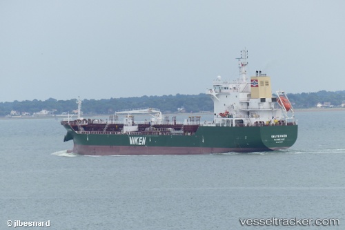
Vessel Skuteviken IMO: 9803651, MMSI: 226344000 Chemical Tanker
UTC, 45.55881, -1.00691, course: 136, speed: 0
UTC, 45.55923, -1.00848, course: 149, speed: 0
2026-01-16 06:52:15 UTC, 45.55923, -1.00849, course: 148, speed: 0
Live AIS position:
UTC. Near Le Verdon),
updated 2026-01-16 06:52:15 UTC.
Find the position of the vessel Skuteviken on the map. The latter are known coordinates and path.
marine traffic ship tracker show on live map
The current position of vessel Skuteviken is 45.55923 lat / -1.00849 lng. Updated: 2026-01-16 06:52:15 UTCCurrently sailing under the flag of France
Details:
Last coordinates of the vessel:
UTC, 45.55812, -1.00699, course: 86, speed: 0UTC, 45.55881, -1.00691, course: 136, speed: 0
UTC, 45.55923, -1.00848, course: 149, speed: 0
2026-01-16 06:52:15 UTC, 45.55923, -1.00849, course: 148, speed: 0