 vesseltracker.com
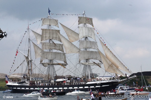
Vessel Belem IMO: 8622983, MMSI: 227051000 Training Ship
UTC, 47.27661, -2.19963, course: 10, speed: 0
UTC, 47.27656, -2.19961, course: 11, speed: 0
2026-01-27 22:14:43 UTC, 47.27663, -2.19960, course: 10, speed: 0
Live AIS position:
UTC. Near ST NAZAIRE),
updated 2026-01-27 22:14:43 UTC.
Find the position of the vessel Belem on the map. The latter are known coordinates and path.
marine traffic ship tracker show on live map
The current position of vessel Belem is 47.27663 lat / -2.19960 lng. Updated: 2026-01-27 22:14:43 UTCCurrently sailing under the flag of France
Details:
Last coordinates of the vessel:
UTC, 47.27660, -2.19959, course: 10, speed: 0UTC, 47.27661, -2.19963, course: 10, speed: 0
UTC, 47.27656, -2.19961, course: 11, speed: 0
2026-01-27 22:14:43 UTC, 47.27663, -2.19960, course: 10, speed: 0