 vesseltracker.com
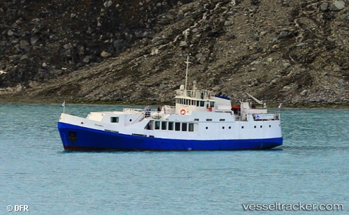
Vessel Polaris I IMO: 4500163, MMSI: 228016600 Cruise Ship
UTC, 49.92095, 1.08783, course: 137, speed: 0
UTC, 49.92095, 1.08783, course: 137, speed: 0
UTC, 49.92095, 1.08783, course: 137, speed: 0
UTC, 49.92095, 1.08783, course: 137, speed: 0
2026-01-08 14:53:48 UTC, 49.92095, 1.08783, course: 137, speed: 0
Live AIS position:
UTC. Near Neuville-lès-Dieppe),
updated 2026-01-08 14:53:48 UTC.
Find the position of the vessel Polaris I on the map. The latter are known coordinates and path.
marine traffic ship tracker show on live map
The current position of vessel Polaris I is 49.92095 lat / 1.08783 lng. Updated: 2026-01-08 14:53:48 UTCDetails:
Last coordinates of the vessel:
UTC, 49.92096, 1.08783, course: 137, speed: 0UTC, 49.92095, 1.08783, course: 137, speed: 0
UTC, 49.92095, 1.08783, course: 137, speed: 0
UTC, 49.92095, 1.08783, course: 137, speed: 0
UTC, 49.92095, 1.08783, course: 137, speed: 0
2026-01-08 14:53:48 UTC, 49.92095, 1.08783, course: 137, speed: 0