 vesseltracker.com
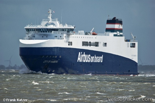
Vessel City Of Hamburg IMO: 9383558, MMSI: 228020700 Ro Ro Cargo Ship
UTC, 47.19200, -1.59450, course: 255, speed: 0
UTC, 47.19198, -1.59446, course: 255, speed: 0
2026-01-18 14:00:24 UTC, 47.19202, -1.59446, course: 255, speed: 0.1
Live AIS position:
UTC. Near Nantes),
updated 2026-01-18 14:00:24 UTC.
Find the position of the vessel City Of Hamburg on the map. The latter are known coordinates and path.
marine traffic ship tracker show on live map
The current position of vessel City Of Hamburg is 47.19202 lat / -1.59446 lng. Updated: 2026-01-18 14:00:24 UTCCurrently sailing under the flag of France
City Of Hamburg built in 2008 year
Deadweight:
3546 tDetails:
Last coordinates of the vessel:
UTC, 47.19198, -1.59450, course: 255, speed: 0UTC, 47.19200, -1.59450, course: 255, speed: 0
UTC, 47.19198, -1.59446, course: 255, speed: 0
2026-01-18 14:00:24 UTC, 47.19202, -1.59446, course: 255, speed: 0.1