 vesseltracker.com
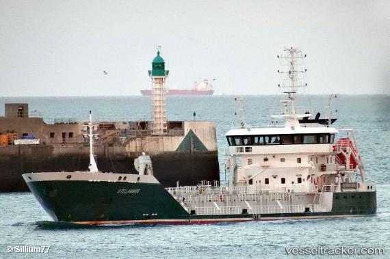
Vessel Stellamaris IMO: 9614751, MMSI: 228032800 Aggregates Carrier
UTC, 47.21910, -1.81619, course: 309, speed: 14
UTC, 47.00465, -2.56363, course: 233, speed: 2
2026-01-14 17:49:19 UTC, 46.99797, -2.57793, course: 69, speed: 3
Live AIS position:
UTC. 13 nm S of Saint-Céols),
updated 2026-01-14 17:49:19 UTC.
Find the position of the vessel Stellamaris on the map. The latter are known coordinates and path.
marine traffic ship tracker show on live map
The current position of vessel Stellamaris is 46.99797 lat / -2.57793 lng. Updated: 2026-01-14 17:49:19 UTCCurrently sailing under the flag of France
Stellamaris built in 2012 year
Deadweight:
4720 tDetails:
Last coordinates of the vessel:
UTC, 47.19768, -1.67773, course: 298, speed: 10.6UTC, 47.21910, -1.81619, course: 309, speed: 14
UTC, 47.00465, -2.56363, course: 233, speed: 2
2026-01-14 17:49:19 UTC, 46.99797, -2.57793, course: 69, speed: 3