 vesseltracker.com
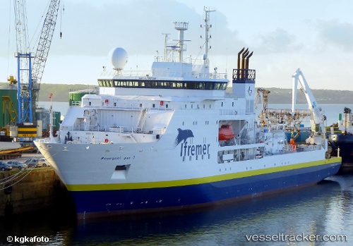
Vessel Pourquoipas IMO: 9285548, MMSI: 228207600 Research Vessel
UTC, 37.73500, -25.65833, course: -1, speed: 0
UTC, 37.64883, -26.04195, course: 259, speed: 10.8
2026-03-01 11:32:56 UTC, 37.60516, -26.27734, course: 257, speed: 10.1
Live AIS position:
UTC. 21 nm W of Cuevas del Campo),
updated 2026-03-01 11:32:56 UTC.
Find the position of the vessel Pourquoipas on the map. The latter are known coordinates and path.
marine traffic ship tracker show on live map
The current position of vessel Pourquoipas is 37.60516 lat / -26.27734 lng. Updated: 2026-03-01 11:32:56 UTCCurrently sailing under the flag of France
Pourquoipas built in 2005 year
Deadweight:
1250 tDetails:
Last coordinates of the vessel:
UTC, 37.73500, -25.65833, course: -1, speed: 0UTC, 37.73500, -25.65833, course: -1, speed: 0
UTC, 37.64883, -26.04195, course: 259, speed: 10.8
2026-03-01 11:32:56 UTC, 37.60516, -26.27734, course: 257, speed: 10.1