 vesseltracker.com
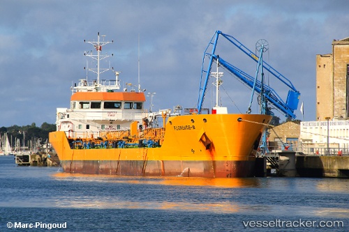
Vessel Florence B IMO: 9406984, MMSI: 228292700 Chemical Oil Products Tanker
UTC, 43.39128, 4.94926, course: -1, speed: 11.5
UTC, 43.41830, 4.83468, course: -1, speed: 0
2026-03-04 02:16:00 UTC, 43.41833, 4.83463, course: 131, speed: 0
Live AIS position:
UTC. Near SAINT LOUIS DU RHONE),
updated 2026-03-04 02:16:00 UTC.
Find the position of the vessel Florence B on the map. The latter are known coordinates and path.
marine traffic ship tracker show on live map
The current position of vessel Florence B is 43.41833 lat / 4.83463 lng. Updated: 2026-03-04 02:16:00 UTCCurrently sailing under the flag of France
Florence B built in 2008 year
Deadweight:
3536 tDetails:
Last coordinates of the vessel:
UTC, 43.39554, 4.98986, course: -1, speed: 0UTC, 43.39128, 4.94926, course: -1, speed: 11.5
UTC, 43.41830, 4.83468, course: -1, speed: 0
2026-03-04 02:16:00 UTC, 43.41833, 4.83463, course: 131, speed: 0