 vesseltracker.com
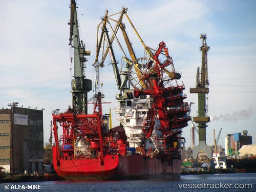
Vessel ILE DYEU IMO: 9230414, MMSI: 228417900 Pipe-Layer
UTC, -34.23000, 151.56667, course: -1, speed: 0
UTC, -34.24298, 151.58269, course: 130, speed: 0.7
2026-01-31 06:27:12 UTC, -34.24660, 151.58823, course: 132, speed: 0.4
Live AIS position:
UTC. 15 nm NE of Milsons Point),
updated 2026-01-31 06:27:12 UTC.
Find the position of the vessel ILE DYEU on the map. The latter are known coordinates and path.
marine traffic ship tracker show on live map
The current position of vessel ILE DYEU is -34.24660 lat / 151.58823 lng. Updated: 2026-01-31 06:27:12 UTCCurrently sailing under the flag of France (RIF)
ILE DYEU built in 2001 year
Deadweight:
13129 tDetails:
Last coordinates of the vessel:
UTC, -34.21515, 151.54782, course: 130, speed: 0.4UTC, -34.23000, 151.56667, course: -1, speed: 0
UTC, -34.24298, 151.58269, course: 130, speed: 0.7
2026-01-31 06:27:12 UTC, -34.24660, 151.58823, course: 132, speed: 0.4