 vesseltracker.com
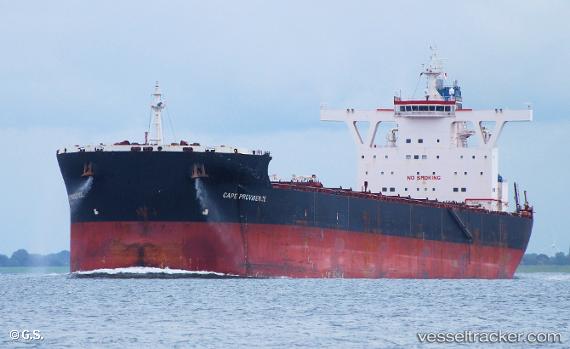
Vessel MINERVA PROVIDENCE IMO: 9461257, MMSI: 229062000 Bulk Carrier
UTC, 29.79481, 122.12180, course: 105, speed: 0
UTC, 29.79486, 122.12176, course: 105, speed: 0
2026-03-13 04:10:30 UTC, 29.79492, 122.12179, course: 105, speed: 0
Live Vessel MINERVA PROVIDENCE Analytics (details, animations, etc.)
Live AIS position: UTC. 10 nm SE of Daxie Pt), updated 2026-03-13 04:10:30 UTC.Find the position of the vessel MINERVA PROVIDENCE on the map. The latter are known coordinates and path.
marine traffic ship tracker show on live map
The current position of vessel MINERVA PROVIDENCE is 29.79492 lat / 122.12179 lng. Updated: 2026-03-13 04:10:30 UTCCurrently sailing under the flag of Malta
MINERVA PROVIDENCE built in 2010 year
Deadweight:
169234 tDetails:
Last coordinates of the vessel:
UTC, 29.79481, 122.12177, course: 105, speed: 0UTC, 29.79481, 122.12180, course: 105, speed: 0
UTC, 29.79486, 122.12176, course: 105, speed: 0
2026-03-13 04:10:30 UTC, 29.79492, 122.12179, course: 105, speed: 0