 vesseltracker.com
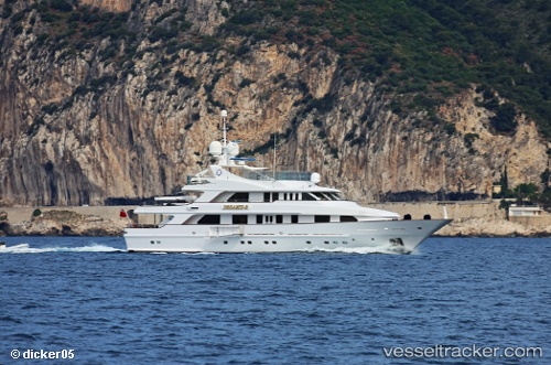
Vessel Desamis B IMO: 9028067, MMSI: 229091000 Service Ship
UTC, 44.42068, 8.84786, course: 201, speed: 0
UTC, 44.42063, 8.84782, course: 201, speed: 0
2026-01-18 14:09:56 UTC, 44.42066, 8.84789, course: 201, speed: 0
Live AIS position:
UTC. Near Sestri Ponente),
updated 2026-01-18 14:09:56 UTC.
Find the position of the vessel Desamis B on the map. The latter are known coordinates and path.
marine traffic ship tracker show on live map
The current position of vessel Desamis B is 44.42066 lat / 8.84789 lng. Updated: 2026-01-18 14:09:56 UTCCurrently sailing under the flag of Malta
Details:
Last coordinates of the vessel:
UTC, 44.42063, 8.84790, course: 201, speed: 0UTC, 44.42068, 8.84786, course: 201, speed: 0
UTC, 44.42063, 8.84782, course: 201, speed: 0
2026-01-18 14:09:56 UTC, 44.42066, 8.84789, course: 201, speed: 0