 vesseltracker.com
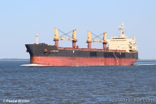
Vessel Diamond Sky IMO: 9468138, MMSI: 229141000 Bulk Carrier
UTC, 40.64585, -74.09677, course: -1, speed: 0
UTC, 40.64580, -74.09677, course: 85, speed: 0
2026-02-01 19:37:09 UTC, 40.64585, -74.09673, course: 83, speed: 0
Live AIS position:
UTC. Near Tompkinsville),
updated 2026-02-01 19:37:09 UTC.
Find the position of the vessel Diamond Sky on the map. The latter are known coordinates and path.
marine traffic ship tracker show on live map
The current position of vessel Diamond Sky is 40.64585 lat / -74.09673 lng. Updated: 2026-02-01 19:37:09 UTCDetails:
Last coordinates of the vessel:
UTC, 40.64577, -74.09683, course: 83, speed: 0UTC, 40.64585, -74.09677, course: -1, speed: 0
UTC, 40.64580, -74.09677, course: 85, speed: 0
2026-02-01 19:37:09 UTC, 40.64585, -74.09673, course: 83, speed: 0