 vesseltracker.com
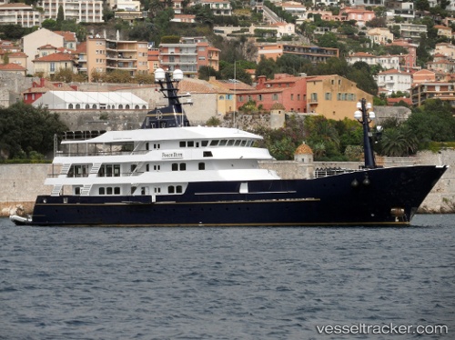
Vessel FORCE BLUE IMO: 1007524, MMSI: 229169000 Houseboat
UTC, 43.85910, 10.23931, course: -1, speed: 0
UTC, 43.85908, 10.23932, course: 332, speed: 0
2026-03-05 21:19:42 UTC, 43.85909, 10.23931, course: -1, speed: 0
Live Vessel FORCE BLUE Analytics (details, animations, etc.)
Live AIS position: UTC. Near Viareggio), updated 2026-03-05 21:19:42 UTC.Find the position of the vessel FORCE BLUE on the map. The latter are known coordinates and path.
marine traffic ship tracker show on live map
The current position of vessel FORCE BLUE is 43.85909 lat / 10.23931 lng. Updated: 2026-03-05 21:19:42 UTCCurrently sailing under the flag of Malta
FORCE BLUE built in 2002 year
Deadweight:
334 tDetails:
Last coordinates of the vessel:
UTC, 43.85910, 10.23932, course: 331, speed: 0UTC, 43.85910, 10.23931, course: -1, speed: 0
UTC, 43.85908, 10.23932, course: 332, speed: 0
2026-03-05 21:19:42 UTC, 43.85909, 10.23931, course: -1, speed: 0