 vesseltracker.com
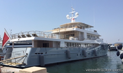
Vessel Elisabet IMO: 9617727, MMSI: 229593000 Service Ship
UTC, 44.34690, 8.66733, course: 94, speed: 13.9
UTC, 44.34690, 8.66733, course: 94, speed: 13.9
UTC, 44.34690, 8.66733, course: 94, speed: 13.9
2026-02-18 09:36:24 UTC, 44.34690, 8.66733, course: 94, speed: 13.9
Live AIS position:
UTC. Near Arenzano),
updated 2026-02-18 09:36:24 UTC.
Find the position of the vessel Elisabet on the map. The latter are known coordinates and path.
marine traffic ship tracker show on live map
The current position of vessel Elisabet is 44.34690 lat / 8.66733 lng. Updated: 2026-02-18 09:36:24 UTCCurrently sailing under the flag of Malta
Elisabet built in 2012 year
Details:
Last coordinates of the vessel:
UTC, 44.35520, 8.56872, course: 156, speed: 0UTC, 44.34690, 8.66733, course: 94, speed: 13.9
UTC, 44.34690, 8.66733, course: 94, speed: 13.9
UTC, 44.34690, 8.66733, course: 94, speed: 13.9
2026-02-18 09:36:24 UTC, 44.34690, 8.66733, course: 94, speed: 13.9