 vesseltracker.com
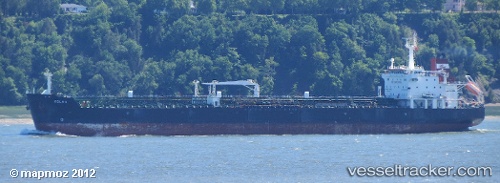
Find the position of the vessel Angi on the map. The latter are known coordinates and path.
marine traffic ship tracker show on live map
The current position of vessel Angi is 39.8103 lat / 25.9414 lng. Updated: 2024-04-26 08:52:50 UTCCurrently sailing under the flag of Malta
Angi built in 2003 year
Port of registry:
Valletta (capital of Malta)Speed:
14.5 knotDeadweight:
37211 tGross tonnage:
23217Service entry:
2003-01-01T00:00:00ZManufacturer:
Hyundai Mipo Dockyard (South Korean shipbuilding company)Details:
Last coordinates of the vessel:
UTC, 39.8106, 25.9413, course: 282, speed: 0UTC, 39.8106, 25.9413, course: 282, speed: 0
UTC, 39.8103, 25.9414, course: 292, speed: 0
2024-04-26 08:52:50 UTC, 39.8103, 25.9414, course: 292, speed: 0