 vesseltracker.com
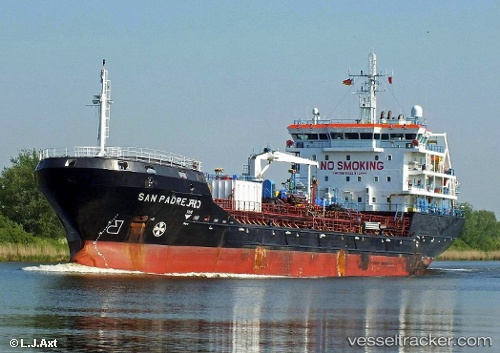
Vessel MARIA IMMACULATA IMO: 9610339, MMSI: 229873000 Chemical/Oil Products Tanker
UTC, 28.15114, -15.39919, course: 358, speed: 0.1
UTC, 28.15122, -15.39914, course: 358, speed: 0
2026-03-06 16:25:48 UTC, 28.15121, -15.39915, course: 358, speed: 0
Live Vessel MARIA IMMACULATA Analytics (details, animations, etc.)
Live AIS position: UTC. Near Las Palmas), updated 2026-03-06 16:25:48 UTC.Find the position of the vessel MARIA IMMACULATA on the map. The latter are known coordinates and path.
marine traffic ship tracker show on live map
The current position of vessel MARIA IMMACULATA is 28.15121 lat / -15.39915 lng. Updated: 2026-03-06 16:25:48 UTCCurrently sailing under the flag of Malta
MARIA IMMACULATA built in 2012 year
Deadweight:
7616 tDetails:
Last coordinates of the vessel:
UTC, 28.14894, -15.40045, course: 13, speed: 1.6UTC, 28.15114, -15.39919, course: 358, speed: 0.1
UTC, 28.15122, -15.39914, course: 358, speed: 0
2026-03-06 16:25:48 UTC, 28.15121, -15.39915, course: 358, speed: 0