 vesseltracker.com
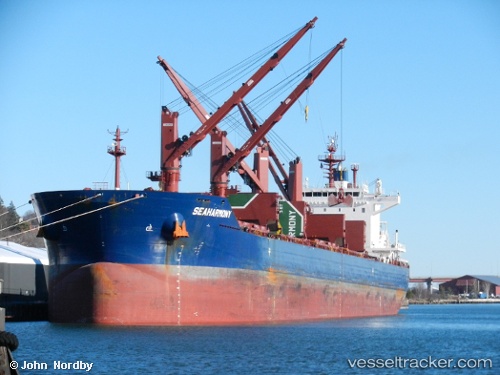
Vessel SEAHARMONY IMO: 9688635, MMSI: 229902000 Bulk Carrier
UTC, 33.13215, -8.73272, course: 27, speed: 0.7
UTC, 33.13216, -8.73222, course: 7, speed: 0.4
2026-02-21 11:20:25 UTC, 33.13167, -8.73167, course: -1, speed: 0
Live AIS position:
UTC. Near Jorf Lasfar),
updated 2026-02-21 11:20:25 UTC.
Find the position of the vessel SEAHARMONY on the map. The latter are known coordinates and path.
marine traffic ship tracker show on live map
The current position of vessel SEAHARMONY is 33.13167 lat / -8.73167 lng. Updated: 2026-02-21 11:20:25 UTCCurrently sailing under the flag of Malta
SEAHARMONY built in 2015 year
Deadweight:
62770 tDetails:
Last coordinates of the vessel:
UTC, 33.13167, -8.73167, course: -1, speed: 0UTC, 33.13215, -8.73272, course: 27, speed: 0.7
UTC, 33.13216, -8.73222, course: 7, speed: 0.4
2026-02-21 11:20:25 UTC, 33.13167, -8.73167, course: -1, speed: 0