 vesseltracker.com
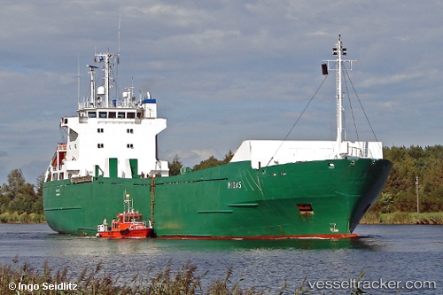
Vessel Midas IMO: 9002659, MMSI: 230186000 Ro Ro Cargo Ship
UTC, 17.76632, -64.15348, course: 78, speed: 12
UTC, 17.82382, -63.87809, course: 75, speed: 12
2026-03-10 19:58:09 UTC, 17.93056, -63.39434, course: 79, speed: 12.2
Live Vessel Midas Analytics (details, animations, etc.)
Live AIS position: UTC. 14 nm NW of Santa Cruz de la Sierra), updated 2026-03-10 19:58:09 UTC.Find the position of the vessel Midas on the map. The latter are known coordinates and path.
marine traffic ship tracker show on live map
The current position of vessel Midas is 17.93056 lat / -63.39434 lng. Updated: 2026-03-10 19:58:09 UTCCurrently sailing under the flag of Finland
Midas built in 1990 year
Deadweight:
4234 tDetails:
Last coordinates of the vessel:
UTC, 17.67500, -64.62833, course: -1, speed: 11UTC, 17.76632, -64.15348, course: 78, speed: 12
UTC, 17.82382, -63.87809, course: 75, speed: 12
2026-03-10 19:58:09 UTC, 17.93056, -63.39434, course: 79, speed: 12.2