 vesseltracker.com
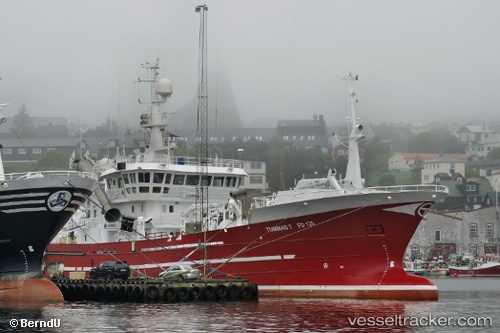
Vessel Tummas T IMO: 9255232, MMSI: 231049000 Fish Carrier
UTC, 62.11213, -6.72655, course: 87, speed: 0
UTC, 62.11220, -6.72656, course: 87, speed: 0
2026-02-25 21:59:56 UTC, 62.11213, -6.72663, course: 87, speed: 0
Live AIS position:
UTC. Near RUNAVIK),
updated 2026-02-25 21:59:56 UTC.
Find the position of the vessel Tummas T on the map. The latter are known coordinates and path.
marine traffic ship tracker show on live map
The current position of vessel Tummas T is 62.11213 lat / -6.72663 lng. Updated: 2026-02-25 21:59:56 UTCCurrently sailing under the flag of Faroe Is
Tummas T built in 2002 year
Details:
Last coordinates of the vessel:
UTC, 62.11217, -6.72648, course: 87, speed: 0UTC, 62.11213, -6.72655, course: 87, speed: 0
UTC, 62.11220, -6.72656, course: 87, speed: 0
2026-02-25 21:59:56 UTC, 62.11213, -6.72663, course: 87, speed: 0