 vesseltracker.com
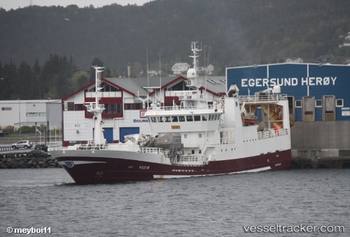
Vessel Katrin Johanna IMO: 9151591, MMSI: 231077000 Fish Carrier
UTC, 62.00346, -6.76764, course: 26, speed: 0
UTC, 62.00340, -6.76757, course: 26, speed: 0
2026-02-08 11:32:16 UTC, 61.92607, -6.66651, course: 160, speed: 11.1
Live AIS position:
UTC. Near GAMLA RAETT),
updated 2026-02-08 11:32:16 UTC.
Find the position of the vessel Katrin Johanna on the map. The latter are known coordinates and path.
marine traffic ship tracker show on live map
The current position of vessel Katrin Johanna is 61.92607 lat / -6.66651 lng. Updated: 2026-02-08 11:32:16 UTCCurrently sailing under the flag of Faroe Is
Katrin Johanna built in 1997 year
Deadweight:
2218 tDetails:
Last coordinates of the vessel:
UTC, 62.00341, -6.76764, course: 26, speed: 0UTC, 62.00346, -6.76764, course: 26, speed: 0
UTC, 62.00340, -6.76757, course: 26, speed: 0
2026-02-08 11:32:16 UTC, 61.92607, -6.66651, course: 160, speed: 11.1