 vesseltracker.com
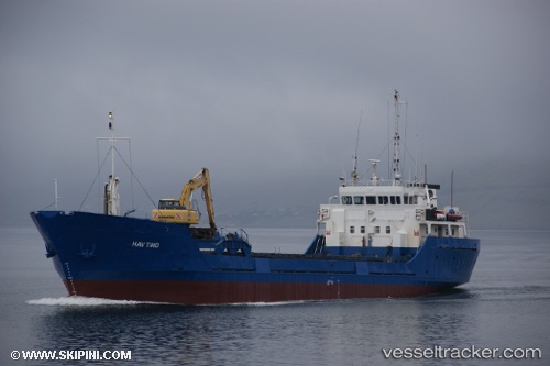
Vessel Hav Tind IMO: 7827249, MMSI: 231565000 General Cargo Ship
UTC, 62.24047, -6.80669, course: 135, speed: 0
UTC, 62.24046, -6.80657, course: 135, speed: 0
2026-02-28 06:02:01 UTC, 62.24038, -6.80664, course: 134, speed: 0
Live AIS position:
UTC. Near FUGLAFJORDUR),
updated 2026-02-28 06:02:01 UTC.
Find the position of the vessel Hav Tind on the map. The latter are known coordinates and path.
marine traffic ship tracker show on live map
The current position of vessel Hav Tind is 62.24038 lat / -6.80664 lng. Updated: 2026-02-28 06:02:01 UTCCurrently sailing under the flag of Faroe Is
Hav Tind built in 1980 year
Deadweight:
1315 tDetails:
Last coordinates of the vessel:
UTC, 62.24046, -6.80664, course: 135, speed: 0.1UTC, 62.24047, -6.80669, course: 135, speed: 0
UTC, 62.24046, -6.80657, course: 135, speed: 0
2026-02-28 06:02:01 UTC, 62.24038, -6.80664, course: 134, speed: 0