 vesseltracker.com
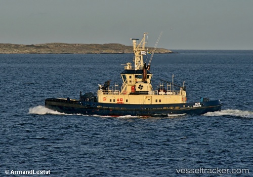
Vessel Bob IMO: 9155236, MMSI: 231801000 Tug
UTC, 58.08661, 11.80562, course: -1, speed: 0.1
UTC, 58.07738, 11.81364, course: -1, speed: 0
2026-03-01 23:24:26 UTC, 58.07740, 11.81365, course: -1, speed: 0
Live AIS position:
UTC. Near Stenungsund),
updated 2026-03-01 23:24:26 UTC.
Find the position of the vessel Bob on the map. The latter are known coordinates and path.
marine traffic ship tracker show on live map
The current position of vessel Bob is 58.07740 lat / 11.81365 lng. Updated: 2026-03-01 23:24:26 UTCCurrently sailing under the flag of Faroe Is
Bob built in 1997 year
Deadweight:
130 tDetails:
Last coordinates of the vessel:
UTC, 58.07729, 11.81355, course: -1, speed: 0UTC, 58.08661, 11.80562, course: -1, speed: 0.1
UTC, 58.07738, 11.81364, course: -1, speed: 0
2026-03-01 23:24:26 UTC, 58.07740, 11.81365, course: -1, speed: 0