 vesseltracker.com
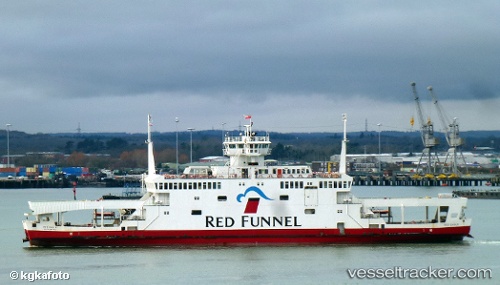
Vessel Red Eagle IMO: 9117337, MMSI: 232002589 Passenger Ro Ro Cargo Ship
UTC, 50.89567, -1.40649, course: 207, speed: 0
UTC, 50.84728, -1.33305, course: 312, speed: 13.5
2026-01-18 20:30:14 UTC, 50.86849, -1.37453, course: 314, speed: 13.6
Live AIS position:
UTC. Near Woolston),
updated 2026-01-18 20:30:14 UTC.
Find the position of the vessel Red Eagle on the map. The latter are known coordinates and path.
marine traffic ship tracker show on live map
The current position of vessel Red Eagle is 50.86849 lat / -1.37453 lng. Updated: 2026-01-18 20:30:14 UTCCurrently sailing under the flag of United Kingdom
Red Eagle built in 1996 year
Deadweight:
612 tDetails:
Last coordinates of the vessel:
UTC, 50.89568, -1.40646, course: 207, speed: 0UTC, 50.89567, -1.40649, course: 207, speed: 0
UTC, 50.84728, -1.33305, course: 312, speed: 13.5
2026-01-18 20:30:14 UTC, 50.86849, -1.37453, course: 314, speed: 13.6