 vesseltracker.com
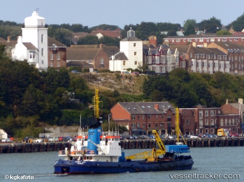
Vessel Cherry Sand IMO: 6811059, MMSI: 232003994 Hopper Dredger
UTC, 53.74090, -0.26497, course: 107, speed: 0
UTC, 53.74088, -0.26497, course: 107, speed: 0
2026-03-25 03:49:45 UTC, 53.74090, -0.26498, course: 107, speed: 0
Live Vessel Cherry Sand Analytics (details, animations, etc.)
Live AIS position: UTC. Near Marfleet), updated 2026-03-25 03:49:45 UTC.Find the position of the vessel Cherry Sand on the map. The latter are known coordinates and path.
marine traffic ship tracker show on live map
The current position of vessel Cherry Sand is 53.74090 lat / -0.26498 lng. Updated: 2026-03-25 03:49:45 UTCCurrently sailing under the flag of United Kingdom
Cherry Sand built in 1968 year
Deadweight:
2305 tDetails:
Last coordinates of the vessel:
UTC, 53.74088, -0.26495, course: 107, speed: 0UTC, 53.74090, -0.26497, course: 107, speed: 0
UTC, 53.74088, -0.26497, course: 107, speed: 0
2026-03-25 03:49:45 UTC, 53.74090, -0.26498, course: 107, speed: 0