 vesseltracker.com
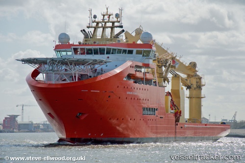
Vessel SEVEN OCEANIC IMO: 9468205, MMSI: 232026676 Offshore Support Vessel
UTC, 58.99936, 5.66676, course: 293, speed: 0
UTC, 58.99937, 5.66678, course: 293, speed: 0
2026-03-17 03:50:06 UTC, 58.99932, 5.66682, course: 293, speed: 0
Live Vessel SEVEN OCEANIC Analytics (details, animations, etc.)
Live AIS position: UTC. Near DUSANIK), updated 2026-03-17 03:50:06 UTC.Find the position of the vessel SEVEN OCEANIC on the map. The latter are known coordinates and path.
marine traffic ship tracker show on live map
The current position of vessel SEVEN OCEANIC is 58.99932 lat / 5.66682 lng. Updated: 2026-03-17 03:50:06 UTCCurrently sailing under the flag of Isle of Man
SEVEN OCEANIC built in 2011 year
Deadweight:
11300 tDetails:
Last coordinates of the vessel:
UTC, 58.99937, 5.66680, course: 293, speed: 0UTC, 58.99936, 5.66676, course: 293, speed: 0
UTC, 58.99937, 5.66678, course: 293, speed: 0
2026-03-17 03:50:06 UTC, 58.99932, 5.66682, course: 293, speed: 0