 vesseltracker.com
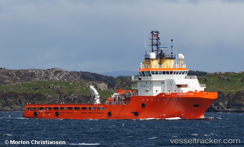
Vessel OCEANICASUB XVII IMO: 9371385, MMSI: 232059264 Anchor Handling Vessel
UTC, 62.32312, 5.84548, course: 127, speed: 0
UTC, 62.32309, 5.84547, course: 128, speed: 0
2026-02-24 04:10:04 UTC, 62.32312, 5.84556, course: 127, speed: 0
Live AIS position:
UTC. Near Ulsteinvik),
updated 2026-02-24 04:10:04 UTC.
Find the position of the vessel OCEANICASUB XVII on the map. The latter are known coordinates and path.
marine traffic ship tracker show on live map
The current position of vessel OCEANICASUB XVII is 62.32312 lat / 5.84556 lng. Updated: 2026-02-24 04:10:04 UTCCurrently sailing under the flag of United Kingdom
Details:
Last coordinates of the vessel:
UTC, 62.32308, 5.84547, course: 128, speed: 0UTC, 62.32312, 5.84548, course: 127, speed: 0
UTC, 62.32309, 5.84547, course: 128, speed: 0
2026-02-24 04:10:04 UTC, 62.32312, 5.84556, course: 127, speed: 0