 vesseltracker.com
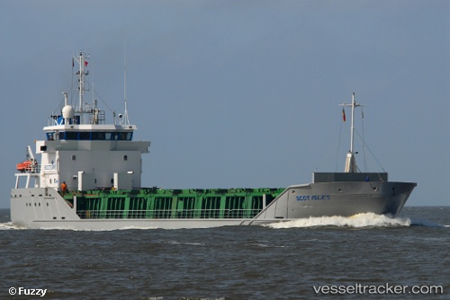
Vessel Scot Isles IMO: 9243930, MMSI: 232974000 Multi Purpose Carrier
UTC, 55.03896, -1.38138, course: -1, speed: 0.6
UTC, 55.03896, -1.38138, course: -1, speed: 0.6
2026-03-02 03:18:22 UTC, 55.03896, -1.38138, course: -1, speed: 0.6
Live AIS position:
UTC. Near Tyne River),
updated 2026-03-02 03:18:22 UTC.
Find the position of the vessel Scot Isles on the map. The latter are known coordinates and path.
marine traffic ship tracker show on live map
The current position of vessel Scot Isles is 55.03896 lat / -1.38138 lng. Updated: 2026-03-02 03:18:22 UTCCurrently sailing under the flag of United Kingdom
Scot Isles built in 2001 year
Deadweight:
3154 tDetails:
Last coordinates of the vessel:
UTC, 55.03875, -1.38227, course: -1, speed: 0UTC, 55.03896, -1.38138, course: -1, speed: 0.6
UTC, 55.03896, -1.38138, course: -1, speed: 0.6
2026-03-02 03:18:22 UTC, 55.03896, -1.38138, course: -1, speed: 0.6