 vesseltracker.com
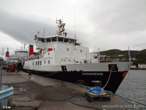
 Lochnevis
Current Status
Where is the vessel?
Lochnevis is currently in Near Armadale, Isle of Skye, based on AIS data received about 1h ago.
Latest AIS update:
Current position: 57.06499° N, 5.89401° W (Near Armadale, Isle of Skye)
Average speed (last 7 days): Loading…
Average speed (last 30 days): Loading…
Vessel profile: Lochnevis is a Passenger Ro Ro Cargo Ship with dimensions 49m x 11m.
This page combines live AIS, route history, probable destination signals, nearby traffic, and port activity for practical vessel monitoring.
The current position of vessel Lochnevis is 57.06499 lat / -5.89401 lng. Updated: 2026-03-25 08:08:30 UTCNearest reference points:
- Near KYLE OF LOCHALSH
- Near Fishnish, Isle of Mull
- Near CRAIGNURE PIER
Currently sailing under the flag of United Kingdom ![]()
Lochnevis built in 2000 year
Deadweight:
115 tDetails:
Live Vessel Lochnevis Analytics (details, animations, etc.)
Recent AIS points (UTC):
2026-03-25 02:26:02 UTC · 57.00690, -5.82653 · SOG 0 kn · COG 212°2026-03-25 03:52:01 UTC · 57.00690, -5.82652 · SOG 0 kn · COG 212°
2026-03-25 05:20:11 UTC · 57.00691, -5.82652 · SOG 0 kn · COG 212°
2026-03-25 08:08:30 UTC · 57.06499, -5.89401 · SOG 0 kn · COG 60°